Features GeoApp Schwäbisch Hall
City map, aerial photos, municipal geodata and tourist information for the city of Schwäbisch Hall.
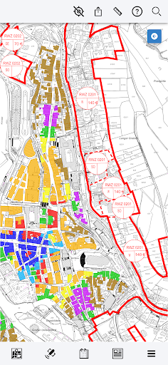
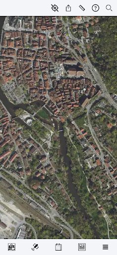
The GeoApp of the city of Schwäbisch Hall provides the city map, aerial photos, tourist information, municipal geodata with detailed specialist information and a link to the event calendar and press releases for the entire municipal area.
Where is the nearest playground - where is there a free parking space - when does the next bus leave?Which development plan or land value applies to my property?
The geoportal of the city of Schwäbisch Hall - now also mobile.Take a look at our cards!
Gaming Features
Enjoy immersive gaming experience with various game modes.
Camera Features
Advanced camera features with editing capabilities.
Productivity Tools
Boost your productivity with powerful tools and features.
See the GeoApp Schwäbisch Hall in Action

Get the App Today
Available for Android 8.0 and above